Atlantic Canada Braces for Heavy Snow and High Winds From Winter Storm
A powerful winter storm is descending upon Atlantic Canada, promising a significant dose of late-season winter weather. Residents across the region are being urged to prepare for a potent mix of heavy, wet snow and damaging wind gusts that threaten to disrupt travel, cause power outages, and create hazardous conditions. This system serves as a stark reminder that winter is not yet ready to release its grip on the eastern provinces.
A Detailed Look at the Storm’s Path and Impacts
The storm, moving in from the Great Lakes and the northeastern United States, is forecast to intensify as it tracks across the region. The combination of abundant moisture and cold air is setting the stage for a classic nor’easter-style event, with impacts varying significantly depending on geography.
Regional Forecast Breakdown: Snowfall Totals and Wind Warnings
Meteorologists are highlighting a sharp gradient in snowfall amounts. Areas closer to the Atlantic coast, including parts of Nova Scotia and Prince Edward Island, may see a mix of rain and snow, limiting some accumulations. However, inland and northern sections are bracing for the brunt of the storm.
*
*
*
Primary Hazards and Public Safety Advice
The dual threat of heavy snow and high winds creates a cascade of potential dangers. Authorities are emphasizing preparedness and caution.
Power Outages and Travel Disruptions
The consensus among utility companies and officials is that widespread power outages are likely. The combination of heavy, sticky snow weighing down branches and fierce winds knocking them into power lines is a recipe for electrical disruptions. Residents are advised to:
*
*
*
Travel is expected to become difficult to impossible during the height of the storm. Rapidly accumulating snow and strong winds will create near-zero visibility in blowing snow. Provincial transportation departments are warning against non-essential travel. If you must travel:
*
*
*
Coastal Flooding and Community Preparedness
For coastal communities, the high winds pose an additional risk of storm surge and flooding, particularly during high tide cycles. Residents in vulnerable areas should be aware of local advisories and be prepared to move to higher ground if instructed.
Municipalities are activating their emergency operations centres and pre-positioning crews and equipment. The public is encouraged to check on vulnerable neighbours, such as the elderly or those living alone, to ensure they are also prepared for the storm’s impacts.
Why This Late-Season Storm Packs a Punch
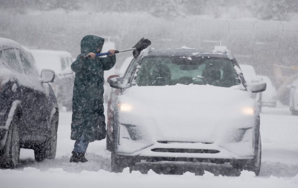
While April storms are not unheard of in Atlantic Canada, this system is notable for its potential intensity. The key factor is the temperature profile. With marginally cold air in place, precipitation will fall as a dense, moisture-laden snow. This “heart-attack snow” is far heavier than the light, fluffy powder of deep winter, putting immense strain on infrastructure.
Furthermore, the storm’s rapid intensification, or “bombogenesis,” is fueling the powerful wind field. This process creates a steep pressure gradient, resulting in the hurricane-force wind gusts anticipated for coastal areas. It’s this combination of heavy precipitation and violent winds that elevates the storm from a mere inconvenience to a serious weather event.
Staying Informed and Looking Ahead
As the situation evolves, staying informed through official sources is critical. Reliable information can be obtained from:
*
*
*
Avoid relying solely on social media for critical updates, as misinformation can spread quickly during weather events. Stick to verified accounts of official agencies.
Once the storm passes, the cleanup will begin. The heavy snow will require careful, paced shovelling to avoid overexertion. Residents should remain cautious of falling ice and damaged branches in the days following the system’s departure.
This impending storm underscores the unpredictable and powerful nature of Atlantic Canada’s weather. By taking proactive steps to prepare, respecting the warnings issued, and prioritizing safety, communities can weather this late-winter blast and look forward to the more tranquil days of spring that lie ahead.