Powerful 7.4 Magnitude Earthquake Strikes Indonesia’s Molucca Sea
The earth once again demonstrated its formidable power as a significant seismic event rocked the waters of Eastern Indonesia. According to the United States Geological Survey (USGS), a powerful earthquake with a preliminary magnitude of 7.4 struck in the Molucca Sea region, sending tremors across the area and triggering immediate tsunami warnings. The event underscores the relentless tectonic activity that defines the Pacific Ring of Fire, a zone where Indonesia is a frequent and vulnerable participant.
A Region Shaken: The Epicenter and Immediate Impact
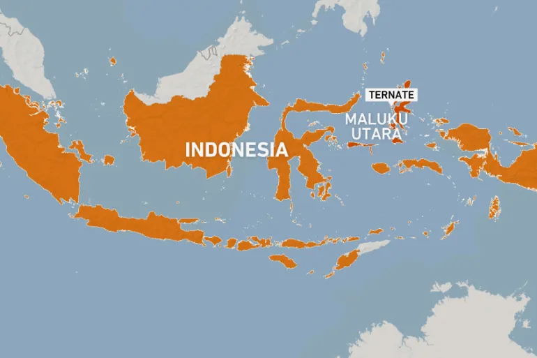
The quake’s epicenter was located approximately 150 kilometers northwest of Tobelo, a coastal town in North Maluku province, at a depth of about 60 kilometers. This significant depth, classified as an intermediate-depth earthquake, likely played a crucial role in mitigating more severe shaking directly at the surface. However, the sheer power of the tremor was felt across a wide area.
Key Details of the Seismic Event:
- Magnitude: 7.4 (as reported by the USGS)
- Location: Molucca Sea, Indonesia
- Depth: Approximately 60 km (intermediate)
- Nearest Land: 150 km NW of Tobelo, North Maluku
Initial reports from local authorities and residents described strong and prolonged shaking, lasting for what felt like minutes to those on nearby islands. People in coastal communities, conditioned by the nation’s tragic history with tsunamis, immediately evacuated to higher ground as sirens blared. The Indonesian geophysics agency (BMKG) swiftly issued a tsunami warning for coastal areas within the potential impact zone, a standard and critical precautionary measure for quakes of this magnitude occurring under the sea.
The Tectonic Engine: Why the Molucca Sea is a Hotspot
To understand why this region is so seismically active, one must look beneath the waves. The Molucca Sea is a complex and convergent tectonic zone, caught in a colossal geological squeeze. It is here that several major tectonic plates interact violently.
The primary mechanism at play is the subduction of the Molucca Sea plate itself. This oceanic plate is being crushed and forced downward, or subducted, beneath the larger Sunda Plate to the west and the Philippine Sea Plate to the east. This creates a unique and highly active double-subduction system, a geological configuration that generates immense stress and friction. When that stress is released suddenly, it results in the powerful earthquakes that frequently jolt the region.
This tectonic setting makes the area prone to:
- Frequent intermediate-depth earthquakes, like today’s event.
- Shallow, potentially more damaging quakes closer to the coast.
- Volcanic activity on the surrounding island arcs.
- The ever-present risk of tsunamis generated by seafloor displacement.
Tsunami Warning: A Tense Vigil and Eventual All-Clear
The moments following a major undersea earthquake are always fraught with tension in Indonesia. The memory of the 2004 Indian Ocean tsunami and the 2018 Palu tsunami are etched deeply into the national consciousness. Following the 7.4 magnitude event, the BMKG’s tsunami warning triggered an immediate and organized response in vulnerable communities.
Residents in coastal areas of North Maluku and North Sulawesi provinces heeded the warnings, moving swiftly to pre-designated evacuation zones. For hours, the situation remained critical as experts analyzed sea level data from monitoring buoys and tidal gauges. The crucial question was whether the quake’s movement had vertically displaced a significant volume of the seafloor—the primary driver of a tsunami.
Fortunately, after a period of intense monitoring, the tsunami warning was lifted. Data indicated that no significant, destructive tsunami waves had been generated. While minor sea level fluctuations were observed, they did not pose a widespread threat. The all-clear signal brought immense relief, but the episode served as a critical and successful drill, testing the nation’s early warning systems and community preparedness.
Damage Assessment and the Human Element
While the tsunami threat subsided, the earthquake’s shaking left its mark. Initial damage reports began to trickle in from the islands closest to the epicenter. The most common impacts included:
- Structural Damage: Reports of cracked walls, collapsed ceilings, and damage to older or less-reinforced buildings in towns like Tobelo and surrounding villages.
- Infrastructure Disruption: Power outages were reported in several areas as the grid was affected. Teams were dispatched to assess roads and bridges for stability.
- Landslides: The quake triggered landslides in some areas with steeper terrain, blocking roads and isolating communities temporarily.
As of the latest updates, there have been no immediate reports of widespread casualties, which authorities attribute to the quake’s offshore location and intermediate depth. Search and rescue teams, along with disaster agency officials, were deployed to the most affected regions to conduct thorough assessments and provide emergency aid where needed. The true extent of the damage, particularly in remote island communities, often takes days to fully comprehend.
Living on the Ring of Fire: Resilience and Preparedness
For the people of Indonesia, seismic events are not a matter of “if” but “when.” The archipelago nation experiences thousands of measurable earthquakes each year, sitting astride the most active tectonic belt on the planet. This reality has fostered a culture of resilience and has driven significant advancements in disaster risk reduction.
Key aspects of Indonesia’s ongoing preparedness efforts include:
- The BMKG Early Warning System: A network of seismic and sea-level sensors designed to provide rapid alerts for earthquakes and potential tsunamis.
- Community Drills and Education: Regular evacuation drills in coastal schools and villages to ensure people know where to go and what to do.
- Building Code Improvements: Ongoing efforts to enforce stricter, earthquake-resistant construction standards, especially in urban areas.
- Public Communication: Utilizing SMS, social media, and sirens to disseminate official warnings quickly and clearly.
Today’s 7.4 magnitude earthquake in the Molucca Sea is a stark reminder of the dynamic forces that shape our planet. It tested systems, stirred fear, but ultimately demonstrated the importance of preparedness and robust early warning technology. While the immediate tsunami threat passed, the event leaves behind a period of assessment and recovery for affected communities, and a renewed focus for the nation on its continuous journey to coexist with the powerful geology beneath its feet. The resilience of the Indonesian people, once again, stands as the first and most vital line of defense against the earth’s unpredictable power.